Home | Places We've Been | Nearby Campsites | Getting Started | Recipes! | Camping Style | Packing | Resources
Claytor Lake State Park
Dublin, VA
- Dates: August 16–17, 2017.
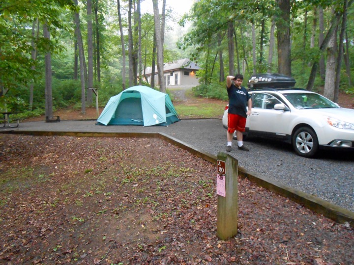
- Site Number: A20
- Coordinates: 37° 3′ 46″ North, 80° 37′ 32″ West
- Vibe:
- Weather:
- Wednesday: Changeable, with some light rain and thunder
- Thursday: Hot and sticky!
- Pros: Great park with lots of amenities. Large gravel sites with great drainage. Fantastic for boaters!
- Cons: None really, except a loud muscle car a couple of sites over.
- Verdict: Not much reason for us to come this far anytime soon, but I really liked this well-run park and can heartlly recommend it.

This free script provided by JavaScript Kit
Steve's Review:
It was a HOT day for traveling! After pulling up stakes in Big Meadows we drove down into the valley to catch I-81 through western Virginia, 200 miles to Claytor Lake State Park. The countryside here is beautiful and reminded me a little bit of sections of Switzerland. The Blue Ridge Parkway begins where Skyline Drive leaves off, so we could see the looming Blue Ridge parallelling our route to the east, and the Allegheny Mountains to the west. In this section of the journey, the watersheds of the Shenandoah River, James River, and their tributaries all make there way east to Chesapeake Bay. As you pass through Buchanan, VA, you enter the Roanoke River watershed, which reaches the Atlantic via Albermarle Bay in North Carolina.
With a fully loaded car, I was reluctant to run the AC. So, we were blasting down I-84 at 70 mph with the windows down. The drive took the better part of the day and we reached Hollins, just outside of Roanoke, around 6 PM. The heat was 93° as we stopped at CVS and Kroger's for batteries and food—definitely the hottest part of the trip so far!
Sure enough, the late day heat and humidity resulted in some rain as we approached Claytor Lake State Park. We quickly set up the tent during a lull in the action and set up only the sleeping pads and bags, as this park was only an overnight along the way. Instead of cooking at camp, we ate a country buffet at Shoney's in nearby Dublin, VA. In retrospect, the meal was pretty mediocre, but we didn't care at all; it served our needs. There was some light rain overnight, but nothing steady.
Packout was easy. After well-deserved hot showers, we swung by the lake on our way out of the park. If you are a boater, this is a fantastic park for you. Claytor Lake is a huge reservoir along the New River and there is a nice marina, as well as swimming area and a lakeside pavilion (nice wedding spot!). Interestingly, the New River drains northward, through West Virginia, to the Ohio River.
I had bought solar eclipse glasses from Amazon several weeks in advance, and while the vendor claimed that the glasses complied with ISO-12312-2-2015 standards, I got an email from Amazon warning that the vendor could not certify that compliance and that Amazon was refunding my purchase (kudos to Amazon for doing the right thing). When we had checked in to Claytor lake, we received a free pair of eclipse glasses that was made by a company that NASA said met the standards, so as we checked out I was able to sweet talk the ranger at the contact station to give us a couple of free pairs so we would all have them during the eclipse. Great people. Well-run. I'd definitely recommend this park.
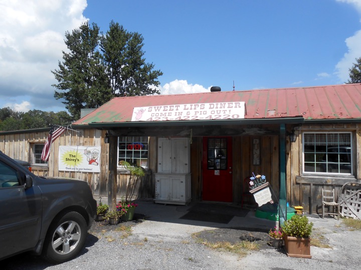
 We continued on I-81 for the 250-mile haul to Smokemont Campground in Great Smoky Mountains National Park. Soon we crossed over to the Tennessee River Valley Watershed. We had three options: we could cut off via I-26 at Johnson City, TN, catch I-40 at Jackson City, TN, or stay on I-81 and take US-441 over the Smokies. We chose the latter route. While nominally shorter in miles, it was the longest route in time, about four-and-a-half hours. Using an app on her phone, my wife found an amazing BBQ joint just off the highway in Mosheim, TN: Sweet Lips Diner! From the outside it looked like a sketchy hole-in-the-wall, but inside was bright and cheery. I had a delicious and vingary pulled pork sandwich. One son had a mile-high bacon cheeseburger and the other had nice chicken tenders. My wife went for the catfish, which was delicious!
We caught US-441 which took us through Sevierville and Pigeon Forge, TN. We were thoroughly unprepared for what we found there. Imagine a ten-mile unplanned strip mall filled with Dollar Generals and other cheap stores. The few spots alog the roadthat were not filled with cheap stores contained serial billboards announcing whatever tawdry thrill lay just ahead. The route is littered with traffic lights, so while the speed limit is (in theory) 45 mph, you're really sitting in stop and go traffic. There is a casino, half of The Titanic, amusement parks galore, chain stores, every kind of fast food imaginable and, as you reach the end of Pigeon Forge, Dollywood, an amusement destination owned by Country and Pop Music star, Dolly Parton.
The heat in this valley town hit 94°! We suddenly found ourselves on the treelined Foothills Parkway leading to Great Smoky Mountains National Park. The temperature instantly dropped several degrees. Before we began the climb over the mountain range we saw the cute town of Gatlinburg, TN. If Pigeon Forge was the epitome of White Trash, Gatlinburg was still commercial, but decidedly more upscale—White Recycling, perhaps. It reminded me of other great mountain towns like Georgetown, CO, or Old Forge or Woodstock in New York. Cute, but slow traveling due to the contant flow of pedestrians crossing the two-lane road.
Gatlinburg had experienced a huge wildfire the previous November. A fire that began at Chimney Tops met with extremely dry timber and wind gusts as high as 87 miles per hour! 14,000 people were evacuated, 2,400 structures wer damaged and 14 lives were lost. The town was closed for a week. Eventually two teens were arrested for starting the fire. Senseless. As we climed the mountains, we could see some areas where the trees were gray and lifeless, but I was amazed at the extent to which Nature had rebounded. There was green everywhere. As we climbed, the air was filled with the clean scent of trees and the temperature continued to drop. By the time we reached Newfound Gap at 5.048 feet, the temperature had dropped 25° to a comfortable 69°! This was a theme that recurred throughout our trip. When it's hot and steamy, get into the mountains!
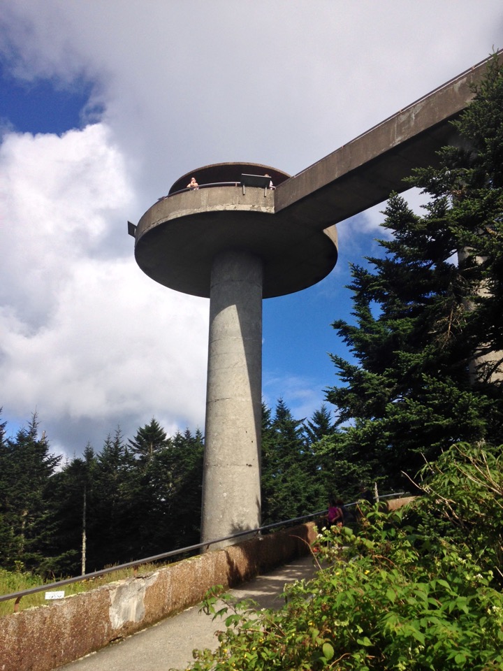
 The weather had improved considerably, so we opted to drive to Clingman's Dome (aka "Old Smoky"), a short seven-mile detour. The summit, the third-highest mountain in the Eastern U.S., is perched at 6,643 feet above sea level and affords stunning 360° views of Tennessee and North Carolina. It also was located withing the 70-mile wide path of totality, and we knew ahead of time that the summit area would be closed for much of our stay in the park, as eclipse watchers had booked spots at the site well in advance of the event.
There was a large parking lot near the summit and a short, 0.5 mile paved path to the observation tower at the summit. While it is short in distance it is easily one of the STEEPEST paths I have even hiked! I wasn't the only one who had to stop several times along the way up to catch my breath. That said, the effort was totally worth it. Access to the 45-foot tall tower is via a gentle concrete ramp. The views were amazing, but my camera ran out of juice, so no photos (sorry). Just a few yards from the summit, the Appalachian Trail crosses Clingman's Dome. My son and I walked the eniture width of the AT! After returning to the car we drove an easy 15 miles downhill to Smokemont.
—SBW
